


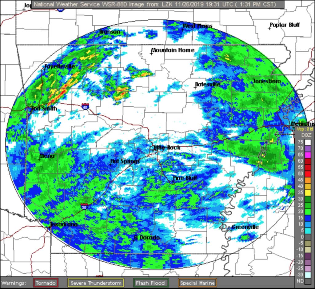
The National Weather Service (NWS) in Little Rock has issued a Hazardous Weather Outlook for a large part of Arkansas. The NWS posted the following on their website today:
DAY ONE…Today and Tonight
Showers and thunderstorms are expected today and tonight with the
best chances for seeing thunderstorms across the southeast half
of the state. The timing for the majority of the thunderstorms is
late this afternoon through the night.
While the overall threat for seeing severe weather is expected to
remain low…a few strong storms could be seen. The best chances
for seeing any strong storms will be along and ahead of a cold
front that will push through the state late Tuesday afternoon
through Tuesday night. The primary concern will be strong and
gusty winds as these storms will be moving very quickly. While
the tornado chance is low, it can not be ignored.
Some breezy southerly winds will possible today before switching
to the west and northwest late tonight Tuesday night into early
Wednesday. Expect winds of 10 to 20 mph…with gusts of 25 to over
30 mph possible.
.DAYS TWO THROUGH SEVEN…Wednesday Through Monday
Breezy conditions will persist for a good part of Wednesday with
the winds diminishing in the afternoon.
More showers and thunderstorms are expected starting late
Wednesday night into Thursday…and are expected to persist into
the weekend. Several rounds of rainfall are forecast…with 2 to
3 inches of rain possible during this time frame. The heaviest
amounts are expected over the northwest half of the state…with
localized flooding possible in areas where the heaviest rainfall
occurs. While some thunderstorms will be possible later in the
week…the overall threat of severe weather will remain low.
Forecasters say severe thunderstorms and a few tornadoes are possible Tuesday in areas along the Mississippi River Valley, according to the Associated Press.
The Storm Prediction Center in Norman, Oklahoma, says northeast Arkansas, southeast Missouri, and extreme western Tennessee are at the greatest risk of severe storms Tuesday.
Forecasters say multiple rounds of thunderstorms are expected in the area ahead of a cold front moving east. Damaging winds are expected to be the biggest concern, but forecasters say tornadoes are possible, too.
The Storm Prediction Center says Tuesday’s stormy weather could affect about 30 million people in an area stretching from Louisiana to Illinois.
To visit the NWS Little Rock website, click here.
 Get up-to-date local and regional news along with the latest sports and weather every weekday morning by listening to Gary B. and Ozark Newsline on Arkansas 103.3 KWOZ. White River Now updates are also broadcast weekday mornings on 93 KZLE, Outlaw 106.5, and 99.5 Hits Now. If you have a news tip or event to promote, email White River Now at news@whiterivernow.com. Be sure to like and follow White River Now on Facebook, Twitter, and Instagram.